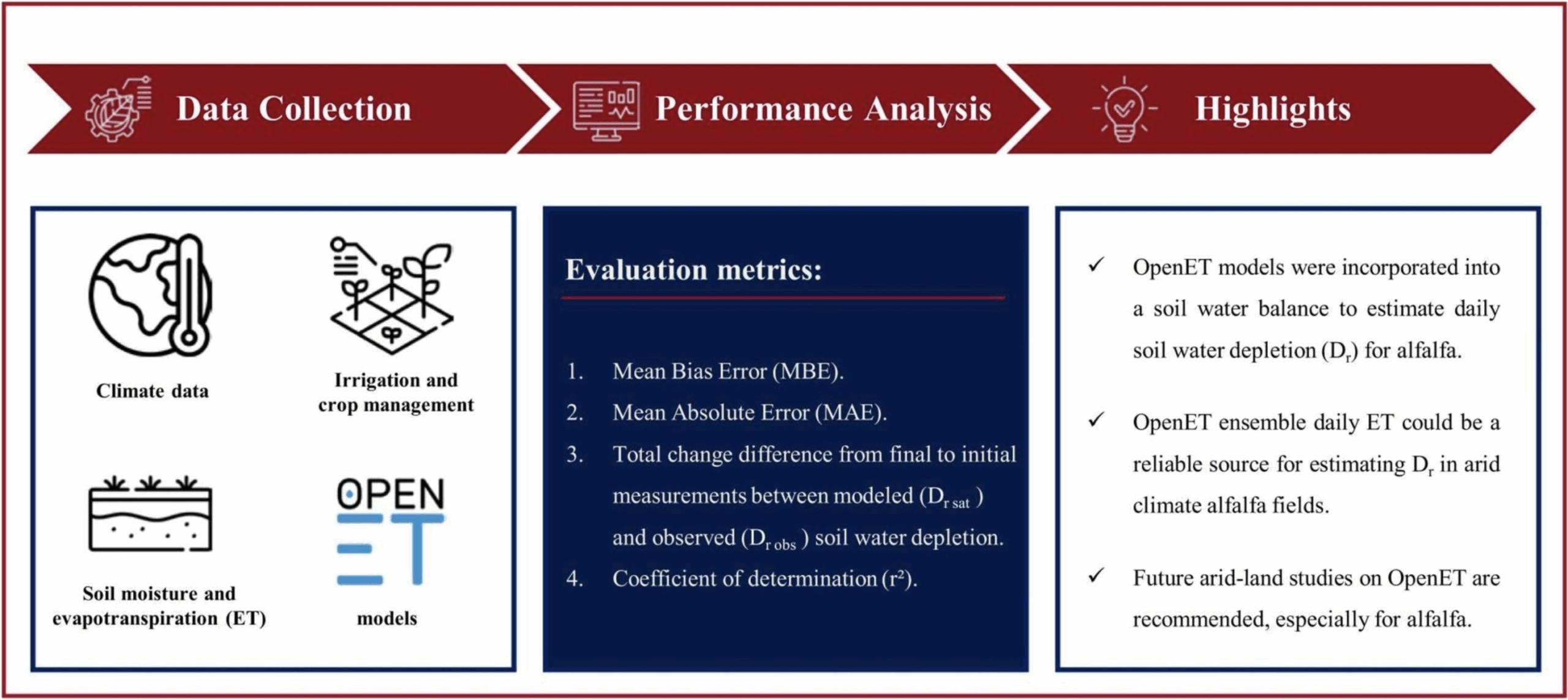
Irrigation consumptive use is crucial information for water resource management and this information is generally not available for most regional and national assessments. From 2000 to 2020, daily estimates of consumptive use were produced for the conterminous U.S. at the 12-digit hydrologic unit code watershed level. Using the Simplified Surface Energy Balance model within the OpenET tool on Google Earth Engine, actual evapotranspiration estimates were derived from Landsat land surface temperature data. These estimates were mapped to the National Hydrologic Model (NHM) spatial units for irrigated areas defined by the Landsat Irrigation Dataset (LANID). The NHM allows for simultaneous estimation of consumptive use and effective precipitation. Results were compared to the 2015 USGS water use report, revealing annual maximum difference in consumptive use of 37 cm, with an average absolute difference of 13 cm and a bias of 2.7 %. Comparisons to field resolution irrigation withdrawals reported by growers in 4 major irrigation regions across the nation were made using efficiencies reported in the literature. These comparisons resulted in root mean square errors that ranged between 10 and 18 cm per year and biases of −18.2 to 15.8 %. Significant differences in these different reported estimates represent challenges in accurate data availability and inconsistent methods and definitions used in assessments. Annual consumptive use in the U.S. can vary by 37 % due to droughts, particularly in regions more heavily dependent on precipitation. Significant increases in consumptive use were noted over the 20-year period in western states, especially the Colorado River basin from 2010 to 2020, exacerbating water supply declines.
Estimating irrigation consumptive use for the conterminous United States: coupling satellite-sourced estimates of actual evapotranspiration with a national hydrologic model
Irrigation consumptive use is crucial information for water resource management