OpenET enables efficient calculation of consumptive water use to support sustainable groundwater management in California’s Colusa Subbasin

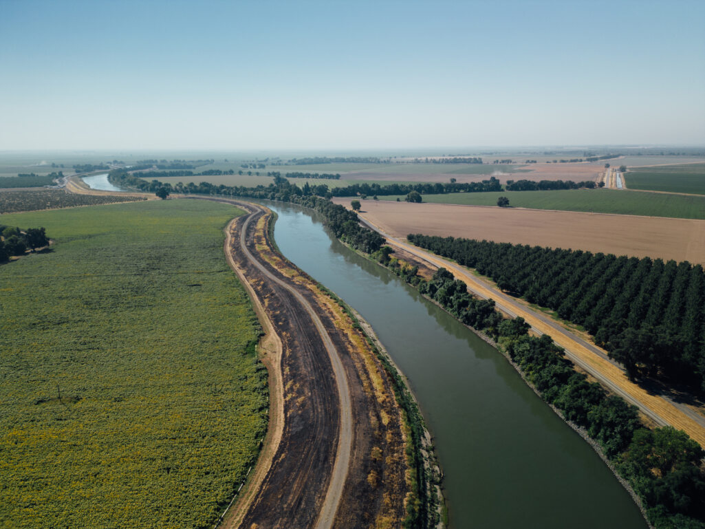
An early tester of the OpenET API highlights its utility for providing efficient and consistent data to support groundwater management

By Katie Klug, Brandon Ertis, Jeff Davids, and Will Carrara

In the Colusa Subbasin, which spans more than 700,000 acres in California’s Sacramento Valley, data obtained through the OpenET application programming interface (API) and data services are being used to help meet the challenge of monitoring water use across a diverse landscape with varying water sources and demands. As beta testers of the OpenET API, Davids Engineering has benefitted from the data services the API provides, especially its utility for easily and efficiently retrieving large quantities of ET data for custom areas and time frames, with greater capabilities for automation and time efficiency.  This is particularly important as the Subbasin’s two groundwater sustainability agencies – the Colusa Groundwater Authority (CGA) and the Glenn Groundwater Authority (GGA) – work with a diverse group of stakeholders to manage the complex groundwater conditions in the Colusa Subbasin under California’s Sustainable Groundwater Management Act (SGMA).

The OpenET API has provided Davids Engineering, the CGA, and GGA a consistent and efficient way to calculate consumptive water use and crop water demand in the Colusa Subbasin during SGMA implementation. To help capture changing conditions over time, Davids Engineering has leveraged spatial ET data from OpenET together with other spatial land use and surface water supply information. These data are used to compute crop water demand and, in turn, model the amount of groundwater pumping needed to meet demand in areas without sufficient surface water supplies. This information is critical for developing water budgets and for evaluating the impacts of hydrologic conditions and groundwater management practices on consumptive water use.

Most recently, Davids Engineering supported the CGA and GGA in evaluating consumptive water use from different sources in the Colusa Subbasin during water years 2021-2022 as part of their Groundwater Sustainability Plan Annual Reports. OpenET was especially valuable for evaluating crop water demand in this two-year period because conditions were vastly different each year. While both years were dry from a hydrologic perspective, water year 2022 saw substantial curtailments of surface water supplies available for irrigation in many parts of California.  In the Colusa Subbasin, these cutbacks led to widespread changes in crop cultivation practices, including substantial idling of rice crops. The impacts that idling had on crop water demand were seen directly in the OpenET data (Figure 1).  OpenET allowed Davids Engineering to capture the full extent and impact of idling on crop water use in 2022 with greater accuracy than might have otherwise been captured using traditional crop coefficient approaches or other data sources with more limited spatial or temporal resolution.

Overall, OpenET has provided many benefits in ongoing efforts to support sustainable groundwater management in the Colusa Subbasin and elsewhere in California.  Davids Engineering plans to continue using OpenET information to evaluate and track changes in water use, develop water budgets, and investigate the impacts of groundwater management practices over the next 20 years. Groundwater sustainability agencies in California, like the CGA and GGA, are leading the way in sustainable groundwater management, and the use of innovative tools like OpenET will help them to achieve their goals.

Figure 1. Map of ET in the Colusa Subbasin in 2021 and 2022 showing the impacts of reduced surface water supplies in 2022. Decreases in ET are observed for the annotated region where land use changed from predominantly rice in 2021 to predominantly fallow in 2022.


We at Davids Engineering have been really impressed with the OpenET API. The endpoints are well-designed, and the Swagger user interface for testing is intuitive. The documentation is comprehensive, including useful code examples. The support team has also been responsive and super helpful.”

Jeff Davids, Davids Engineering


In a statewide first, California is using satellite-based ET data for water use reporting in the Delta

This blog is co-authored by Will Carrara, California State University, Monterey Bay and Garshaw Amidi-Abraham, Environmental Defense Fund.

California is responsible for 12.5% of all agricultural production in the United States, as well as one third of the country’s vegetables and three quarters of its nut and fruit production. This agricultural activity is reliant on a hugely dynamic and complex plumbing system that stores and transports water across the state. And yet, extended droughts over the past two decades have highlighted the need for accurate water measurement and reporting. These data can be used by the state to plan ahead and forecast for times of water scarcity, identify and correct water losses in a diversion system, administer and protect water rights, and efficiently manage water during times of shortage. 

In 2015, the California legislature passed Senate Bill 88, which requires water rights holders and claimants who divert over 10 acre-feet per year to accurately report water diversions to the California State Water Resources Control Board (CA SWRCB). The Delta Alternative Compliance Plan (Delta ACP), which has been under development for the past three years, provides a path to comply with the measurement regulation and simplifies and streamlines annual reporting. 

This requirement poses a particular challenge in the important farming region of the Sacramento-San Joaquin Delta, where 70 different crops are grown across over 415,000 acres, creating nearly 14,000 jobs and $2 billion in output. Most of the agricultural land in the Delta is below sea level and in tidally influenced zones behind protective levees, requiring complex water delivery and management infrastructure. Siphons are used to move water from surrounding channels to agricultural fields. However, these channels can also cause flooding when too much water seeps out onto the fields. Measuring flow through the Delta’s numerous siphons is particularly challenging due to hydraulic turbulence, tidal fluctuation, and ingested debris. Traditional compliance approaches require using flow meters to measure all points of diversion, which in the Delta’s complex hydrologic environment can be especially expensive to install and maintain, and often do not provide the required accuracy

Recognizing this challenge, the Delta water community—including regulators, farmers, exporters, environmental non-profits and water districts—came together in 2020 to develop an approach supported by water users that would fulfill the state’s reporting requirement.  

The Delta Alternative Compliance Plan (Delta ACP) launched on March 16, 2023 by the Central and South Delta Water Agencies. The Delta ACP addresses two problems: improvement of an otherwise complicated and expensive water measurement system and automation of an onerous reporting system. This innovative plan allows farmers to use satellite-based information on evapotranspiration (ET) from OpenET to automatically quantify and report water use to the CA SWRCB, streamlining the water use reporting process in the hydrologically complex San Francisco Bay-Delta region.

Image: USFWS Pacific Southwest Region


Delta Watermaster, Jay Ziegler, is hopeful about the Delta ACP’s ability to both improve the water measurement process in the legally-defined Delta, as well as contribute to the long-term goal of building resiliency through the application of a user-friendly and cost effective water data reporting platform that fosters engagement across all stakeholders to better understand water use data.

“The Delta ACP program is an important step in applying technology to better answer the longstanding difficult water measurement challenges in the Sacramento-San Joaquin Delta,” says Ziegler. “The use of OpenET is a significant and practical improvement in collecting, applying and understanding consumptive water use data in the watershed. Advancing wider understanding about consumptive water use is essential to then engage all stakeholders toward a better understanding of hydrodynamics of the Delta” 

With the Delta ACP system, farmers and water rights holders can automatically retrieve water use data for their farms from the OpenET application programming interface (API) and open data services, which is combined with information automatically retrieved from the CA SWRCB Report Management System API. This represents the first time that satellite data are being used to report water use in California, and the first time that the CA SWRCB water use reporting APIs and open data services from OpenET have been integrated.

The Delta ACP helps farmers and water rights holders report total water use as required under California Water Code Sections 5104 and 1840. With the Delta ACP, the reporting process is streamlined and automated, allowing farmers to complete water use reports in under 10 minutes. This represents a significant improvement over the past reporting systems, where farmers had to hire consultants or spend up to 8 hours to complete the reports for each of the thousands of farms in the Delta region.

Lindsay Kammeier, Water Resource Control Engineer for CA SWRCB and the Office of the Delta Watermaster, sees multiple benefits to implementation of the Delta ACP. “It is a reliable and accurate way for diverters, wider Delta water interests and the regulator to understand consumptive water use in the watershed. It improves data collection and reporting for both users and the SWRCB’s analysis and establishes a common baseline to measure consumptive water use,” says Kammeier. “Open ET provides an accurate calculation of that value for in-Delta agricultural users and closer real-time access to measure water use data. That data is consistent, reliable and credible within the user community.”

Image: Environmental Defense Fund


Brett Baker, sixth-generation pear farmer and legal counsel for the Central Delta Water Agency, has been assisting his community with water reporting for well over a decade. He is excited about the opportunity the Delta ACP and OpenET provide in terms of empowering Delta water users to comply on their own. 

“Following the passage of the Delta Reform Act in 2009, which required diverters within the Legal Delta to annually report their diversion and use of water for the first time, I endeavored to assist my family, friends, and neighbors in fulfilling this new regulatory requirement. I built a business, became an attorney, and started a family. All the while, I hoped to be able to empower Delta water users with the ability to comply with the regulations on their own. OpenET has given us the opportunity to do exactly that,” Brett says.  “The Delta Alternative Compliance Program that we built allows Delta Farmers to continue doing what they do best, which is farm, and allows them to be in full compliance with the law utilizing OpenET’s technology in an easily accessible, affordable, and understandable Application.”

A common understanding of water usage and needs is critical for sustainable water management. This innovative application of OpenET represents one of many potential ways satellite-based data can be mobilized for a whole water community-including growers, water managers and regulators- to better report and effectively manage water usage in a complex system. Perhaps more impressively, water regulators, managers and users agreed on what data to use and how to report the data, ultimately saving money, simplifying the burden of regulatory compliance, and building a foundation for a collaborative future on water measurement in the Delta.